Pointers at Glance
- AI, an innovator in advanced analytics, is launching HeavyRF, an extension of the company’s deep analytics platform.
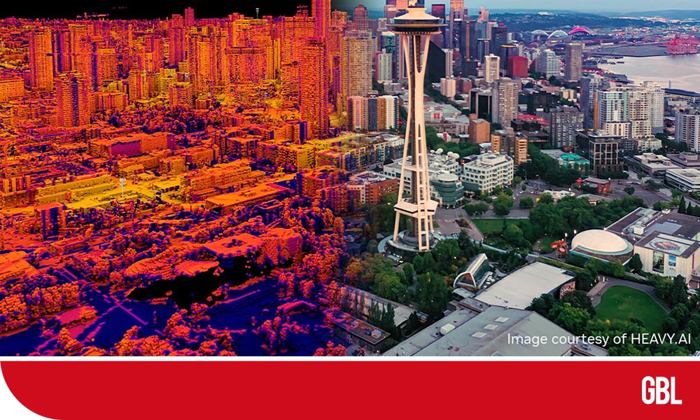
- It uses NVIDIA Omniverse to create digital twins that help telco network operators speed deployments of wireless networks.
HeavyRF allows telcos to simulate potential city-scale deployments as a faster and high efficient way of optimizing cellular-tower and base-station placements for best coverage.
Jon Kondo, CEO of HEAVY.AI, said that 5G infrastructure is very different from 4G infrastructure. It requires far more towers and antennas to provide the highest coverage level and customer satisfaction. Because of that heightened demand, telcos cannot spend the same time planning and locating each piece of 5G infrastructure.
HeavyRF allows telco networks to review historic and current network-performance data as they test site-configuration scenarios against physical impediments, like trees and dense buildings. It seamlessly combines customer-demographic and behavioral data with real-time geophysical mapping and GPU-accelerated analytics.
Also, HEAVY.AI announced extending its collaboration with Charter Communications, the second largest cable provider in the nation.
With the NVIDIA Omniverse, HeavyRF is instantly compatible with a large set of complementary tools for reality capture and advanced antenna and network tools leveraging machine learning. These can be used to design networks even in complexly dynamic environments like ports and to simulate software-defined networks down to the packet level.
HeavyRF allows telco networks to minimize site-deployment costs while maximizing service quality for entire populations and targeted demographic and behavioral profiles.
The module aids network planning and coverage mapping at unprecedented speed and scale. It can be used to quickly develop and evaluate strategic rollout options, including thousands of microcells and non-traditional antennas.
Simulations can be run against full-resolution, physically precise LiDAR and clutter data interactively at a metro regional scale, which avoids downsampling needs and false service qualifications.